



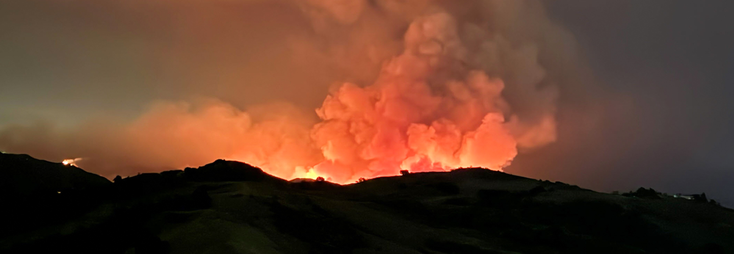
For retired Orange County Fire Authority (OCFA) Division Chief Kevin Fetterman, wildfire response has evolved beyond just flame length and smoke columns.
“I see smoke and I see fire, but my brain is somewhat wired now to see data,” said Fetterman, who now serves as Senior Vice President of Public Safety Strategy with Watch Duty, a wildfire and flood alert app.
Serving 23 cities and protecting nearly 200,000 acres of wildland, Orange County Fire Authority operates in a complex wildland-urban interface where dense population centers border historic fire corridors.
In wildland-urban interface environments, communications technology is paramount. Fetterman explained, “Communication is literally the building block for incident command strategies and tactics.”
The Airport Fire: Speed, detection, and scale
The 2024 Orange County Airport Fire in the Santa Ana Mountains ignited during an exceptionally hot week. Rising temperatures and falling humidity rapidly dried fuels like brush and trees across the region. With forecasts already signaling critical fire weather, OCFA leadership staffed the department operations center in advance. That preparation would prove critical in the coming hours.
OCFA uses not just 9-1-1 calls, but artificial intelligence-enabled cameras to identify fires. A UC San Diego program called Alert California provides a network of more than 1,000 rotating cameras that can flag the ignition of fires and push notifications via text and email to key responders. The system has caught numerous incidents, proving its value in the mitigation of catastrophic wildfires.
“At 1:03 p.m., the Airport Fire broke,” recalled Fetterman, who supported response to the event. Orange County launched a full-scale response that included dozens of fire engines, nine helicopters, fixed-wing air tankers, and command aircraft. To add to the complexity, two other fires — the Line and the Bridge fires — were also burning in the immediate area and OCFA and other agencies had to carefully manage resources.
Even with early notification and significant resources deployed, the fire quickly tested the limits of suppression due to the terrain and weather conditions.
Broadband connectivity as an operational backbone
Throughout the Airport Fire, broadband connectivity underpinned nearly every operational decision. FirstNet devices, dual-SIM phones, deployable assets, satellite backhaul, and radios formed a layered communications stack designed for redundancy.
That connectivity enabled near real-time fire modeling, perimeter mapping, and common operational pictures delivered directly to command vehicles and mobile devices. “Five years ago, if you asked me where the fire was, I’d say, ‘It’s over that ridge,’” Fetterman noted. During the Airport Fire, intelligent aircraft delivered usable fire perimeters within 45 minutes — data that once took 12 to 24 hours to reach incident commanders.
These aircraft are a part of Fire Integrated Real-Time Intelligence System (FIRIS), an aerial intelligence program that provides real-time data for firefighters. FIRIS started as a pilot project innovated by OCFA and is now managed statewide by the California Governor’s Office of Emergency Services.
Connectivity also supported a shared common operating picture across agencies. Command staff could see where engines and aircraft were assigned, how the fire perimeter was evolving, and which areas were most immediately threatened. With other fires in the area in the days before and after, resource management was vital.
With a clear picture of where, when, and how they were responding, the unified command could act with increased confidence and allocate resources appropriately, even across jurisdictions.
A unified picture for unified command
As the Airport Fire expanded, it crossed multiple responsibility areas, requiring unified command between the OCFA and state and federal partners. The fire’s path threatened a range of high-value and sensitive lands, including state responsibility areas, a national forest, wildlife habitats, the nearby communities of Robinson Ranch, Rancho Santa Margarita, and Coto de Caza, a Boy Scout camp, and critical communications towers atop Santiago Peak.
If damaged, the towers had the potential to disrupt service for large portions of Southern California — as well as interrupt communication between responding agencies. Mapping data, live aerial intelligence, real-time fire perimeters, and modeling allowed leaders like Fetterman to prioritize protection efforts in these critical areas. Structure protection engines were surged into residential areas, while aircraft and ground resources worked to slow fire spread toward forested terrain and recreational areas.
Unified command depended on shared situational awareness and constant information flow. Advanced communications support enabled decision-making across human, environmental, and infrastructure priorities, even as the fire rapidly evolved.
Prioritizing integration and innovation
Despite the abundance of tools at their disposal, Chief Fetterman says the future of broadband communications for the fire service can be summed up in one word: integration.
“We all have tons of technology. What we need now is integration and reconciliation of massive amounts of information,” he said. Detection systems, satellites, drones, modeling platforms, and situational awareness tools all exist, but too often operate in silos.
Moving forward, he challenges technologists to continue providing public safety with solutions that are interoperable and compatible with other systems. Just as public safety requires reliable technology to communicate with one another, technology itself needs to communicate together so that decision-makers can quickly compile all available information. This was part of what motivated Fetterman’s move to Watch Duty, a non-profit organization that synthesizes a wide range of technology signals to translate clear, accessible updates for citizens and responders alike.
In his current role, he supports Watch Duty’s efforts in leveraging people, processes, and technology to send alerts to millions of impacted users, preparing them for emergencies with critical information. In incident command, “Decisions made without information are typically hasty. We need all that information to ensure that we're using effective strategies and tactics,” Fetterman said. “It’s only in the last five years we’ve begun to quickly assess the basic questions about a fire — how big, how fast, and where? Technology helps us do that.”
What comes next for the wildland fire service
The Airport Fire ultimately spanned 23,000 acres, even with fire service experts using every tool available to them to quell the spread.
In wildfire response, decision-making is increasingly time-constrained and dependent on rapid information sharing. “No communication equals no data. No data equals no modeling,” Fetterman warned.
For the future of the fire service, strengthening broadband-enabled response, integrating emerging technologies into cohesive systems, and ensuring responders have the information they need when it matters most remains a top priority. FirstNet, the nationwide public safety broadband network, and the FirstNet Authority will continue to work alongside first responders to provide the innovation and connectivity this future demands.
As Fetterman emphasized, “It's foundational — connectivity is fundamental to what we do. It gets boots on the ground faster and makes deployments more efficient.”